The hairpins of the Stelvio Pass road climb a green valley below rocky peaks.

By car · motorbike · bike · on foot

Roads for everyone.

RoamRise is a map of places you visit for the drive itself. It holds 304 roads from the Šumava to the Dolomites, 41 racetracks and 65 bike parks. It plans a round trip from your door and records the ride.

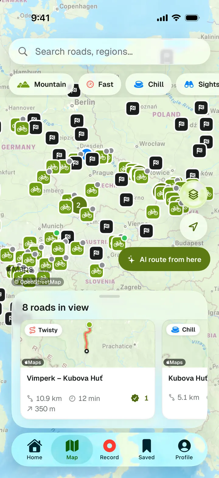
The RoamRise app on iPhone: the map with the Racetracks and Bike parks layers on and place markers across Czechia and its neighbours.
304 roads
4,000 km in five countries
41 racetracks
161 corners described
65 bike parks
426 trails on the map
6 countries
Czechia, Slovakia, Poland, Austria, Germany and Italy

Catalogue as of 15 November 2026

Three catalogues on one map

Roads, racetracks and bike parks are layers you switch on. A road shows its length and curvature, a racetrack its noise limit, a bike park its season dates.

Roads

304 stretches chosen for bends and views

They add up to 4,000 km. Czechia has 173 of them; the rest cross Slovakia, Poland, Austria and the Italian Dolomites: Passo Pordoi, Giau, Sella and Gardena.

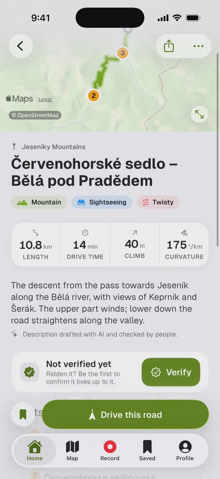
Each stretch shows its length, drive time, climb and curvature per kilometre. Filter by style: mountain, winding, scenic, forest or waterside. Open the route in Mapy.com, Google Maps, Apple Maps or Waze.

A freshly surfaced road bends into a sunlit forest.
A road in the RoamRise app: its line on the map, style tags and figures for length, drive time, climb and curvature.
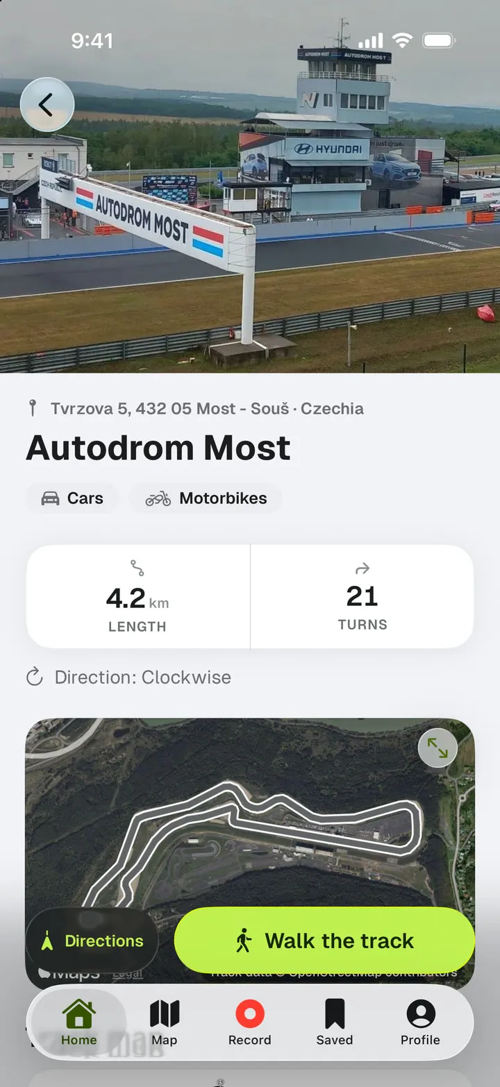
A racetrack in the RoamRise app: the track map, layouts with length and turn count, and a link to track days.
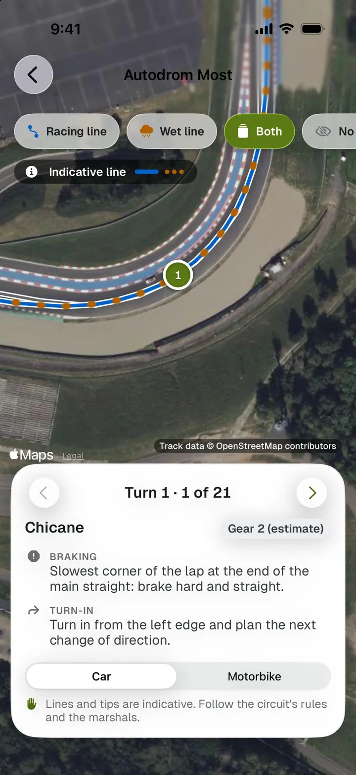
The Walk the track screen: a corner on aerial imagery with the racing line and tips for braking, turn-in, apex and exit.

Racetracks

41 racetracks, and every corner before you get there

Most, Brno, Slovakiaring, Red Bull Ring, Hockenheimring, Mugello and more circuits in six countries. Each lists its layouts with length and turn count, the noise limit, facilities and a link to track days. You see at once whether a circuit takes cars, motorbikes or both.

Walk the track works on eleven circuits. Step through the lap corner by corner over aerial imagery and read where to brake, where to turn in, where the apex sits and how to exit. Each corner adds a wet-weather tip, an estimated gear for car or motorbike and the racing line.

Walk the track covers: Most, Brno, Slovakiaring, Red Bull Ring, Salzburgring, Hockenheimring, Nürburgring, Sachsenring, Mugello, Misano and Tor Poznań.

The first corner at Most, as the app describes it

Autodrom Most Turn 1 · 1 of 21 · Chicane

Braking
Slowest corner of the lap at the end of the main straight: brake hard and straight.
Turn-in
Turn in from the left edge and plan the next change of direction.
Apex
Clip the right apex, using only the low part of the kerb.
Exit
Keep it tight; you must be on the right side to swing into the T2 left.
In the wet
Brake earlier, stay off the kerbs entirely and straighten the line as much as you can.

Gear 2 (estimate)

Lines and tips are indicative. Follow the circuit's rules and the marshals.

Bike parks

65 lift-served bike parks with season dates

In Czechia: Špičák, Klínovec, Kouty, Dolní Morava, Lipno, Ještěd and five more. The others are in Austria, Germany, Italy, Poland and Slovakia.

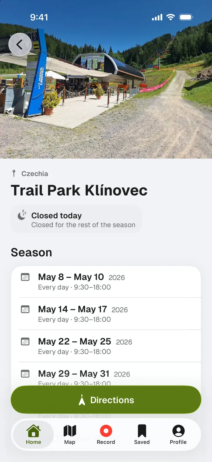
A park shows whether it is open today, and its season dates with the day we checked them. You also get lifts, bike rental, prices and the trails on the map by difficulty.

Save a bike ride with its bike type: road, gravel, MTB or downhill. A downhill day can name the park you rode.

A bike park in the RoamRise app: open today, season dates, lifts and trails by difficulty.

A round trip from your door, sized for one afternoon

Tell it where you start, how long you have and which roads you enjoy. The AI planner builds a loop from catalogue roads, adds stops and brings you back to the start.

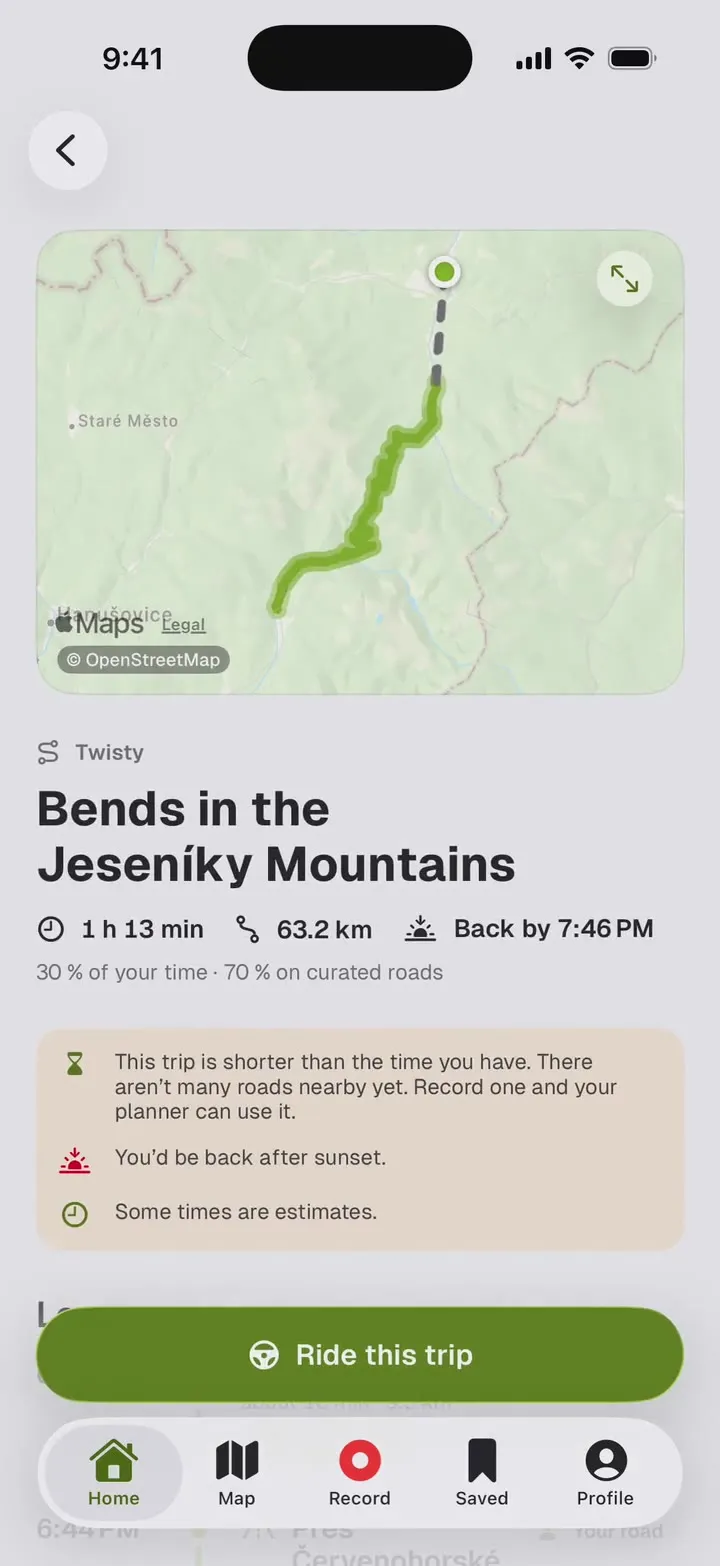
A suggested trip in the RoamRise app: the route on the map, total time, distance and return time.
Four trips the planner suggested from Czech towns
Trip How Time Total On catalogue roads
Bends in the Beskydy MountainsFrom Frenštát pod Radhoštěm By motorbike 2 h 66.1 km 22.5 km
Views of ŠumavaFrom Vimperk By car + on foot 2 h 68.3 km 39.9 km
Views of the Orlické MountainsFrom Šumperk By car + by bike 6 h 168 km 65.5 km
Bends in Bohemian SwitzerlandFrom Děčín By motorbike 2 h 30.2 km 10.2 km

One afternoon in the Jeseníky

Route preview

Hairpins, coffee and a lookout tower

Bends over Červenohorské sedlo, coffee at the top and a walk to Zlatý chlum. Two winding sections of one road, one hike.

3 h 44 min · 68.3 km

Illustrative plan · approximate times and transfers

Route preview

Jeseníky

68.3 km
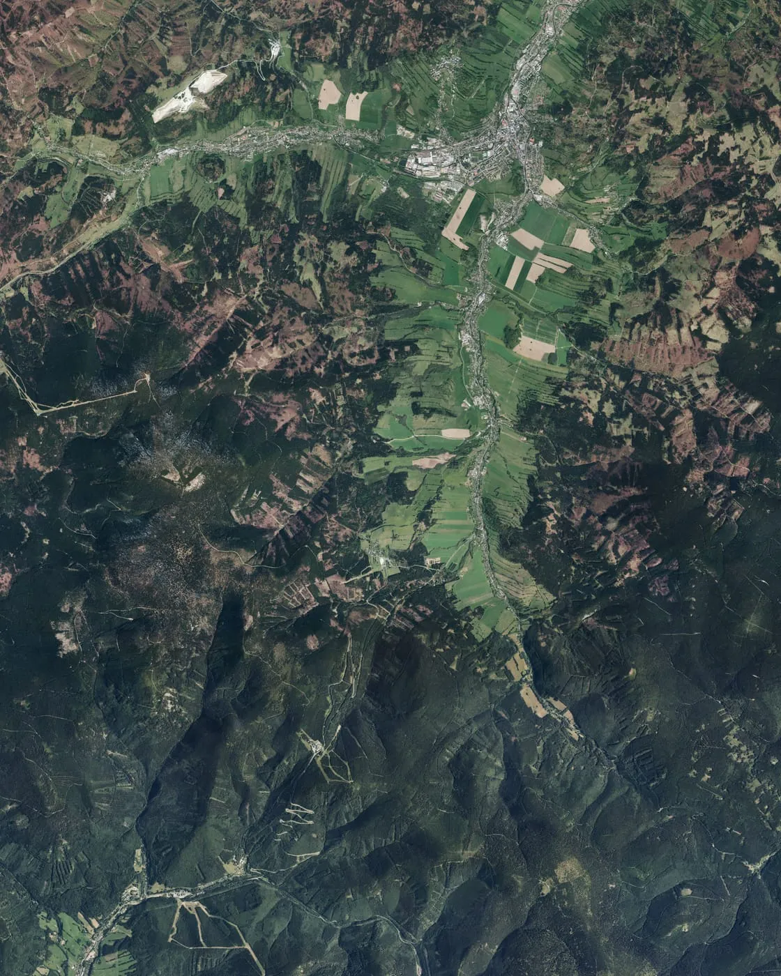
Hairpins over the pass, coffee and Zlatý chlumAn aerial photo of the Jeseníky with the two road sections from Kouty over Červenohorské sedlo to Bělá, coffee at the pass and a hike from Křížový vrch to Zlatý chlum. Start and return in Jeseník. 12 Jeseník START AND RETURN Kouty Bělá Červenohorské sedlo Coffee at the pass Křížový vrch 3 Zlatý chlum 3 · Walk to the lookout tower4 km out and back · +210 m
  • Winding road
  • Walk

Aerial imagery © ČÚZK (CC BY 4.0) · © OpenStreetMap

View the full itinerary
Timetable: Hairpins, coffee and a lookout tower
TimekmRoute
09:000Jeseníkdeparture
09:3528Kouty → Červenohorské sedloverified road, 10.5 km
09:5139Coffee at Hotel Červenohorské sedlocafé, 25 min stop
10:1639Červenohorské sedlo → Běláverified road, 8.8 km
10:2947Transfer20 min, your navigation app picks the way
10:4959Křížový vrch → Zlatý chlum lookout toweron foot, 4.0 km, out and back, 210 m of climbing
12:3463Way back5 km, your navigation app picks the way
12:4468Jeseníkarrival

Seasonal trips

The Grossglockner High Alpine Road below snow-patched mountains and a small lake.

Bike on the roof, boots in the back

Add a cycle or a walk to a day of driving. Park, climb to a lookout tower and take a different road home. The planner counts the drive, the activity and the return.

  1. Home
  2. Selected roads
  3. Park
  4. Cycle or walk
  5. Back home
By car
Back roads and passes for an afternoon, a circuit for the weekend. Read live engine data from the diagnostic port.
By motorbike
Winding roads and the circuits that take motorbikes. Track corners show an estimated gear for a bike.
By bike
Lift-served bike parks, and rides saved by bike type. Add a cycling leg to a day in the car.
On foot
A hike to a lookout tower as a stop on the trip. Record a walk like a drive, with photos and notes.

On the move

Leave the phone in its mount. Recording runs in the background, and time and distance show on the lock screen or your watch.

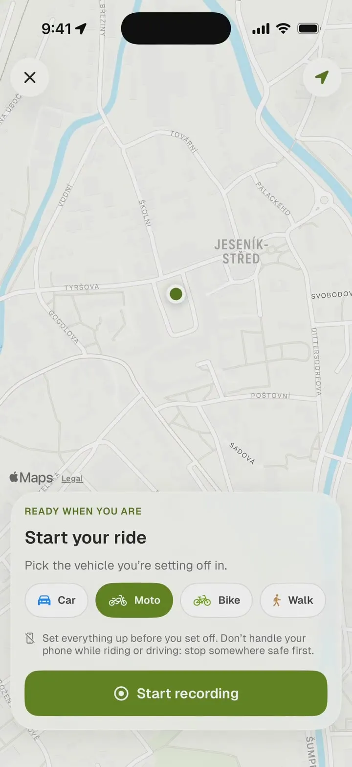
Starting a ride recording in the RoamRise app: the map and a choice of car, motorbike, bike or walk.

Ride recording

Choose car, motorbike, bike or on foot and start recording. Add a photo or a note at a stop. Keep the finished ride to yourself or publish it.

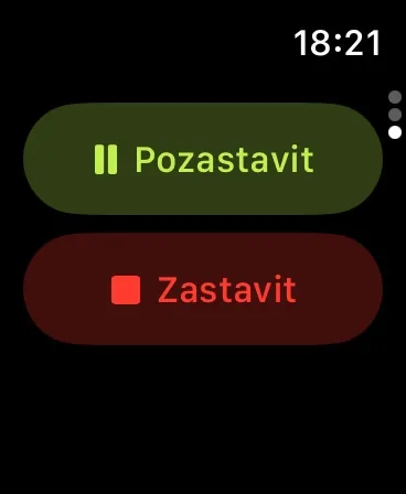
RoamRise on Apple Watch, showing Pause and Stop recording controls in Czech.

Recording on your wrist

See time and distance on Apple Watch. Pause or stop the recording without taking your phone out.

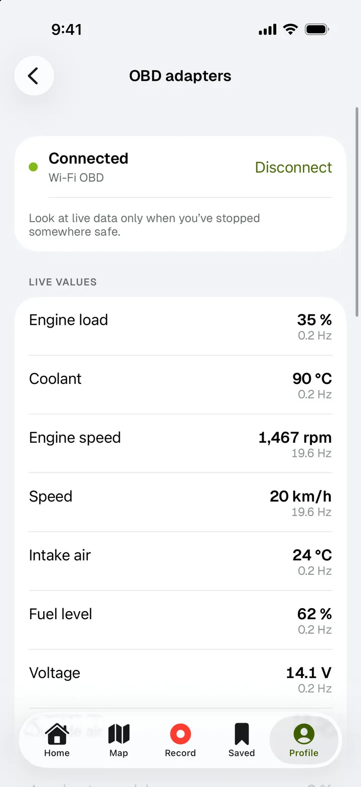
A connected OBD adapter in the RoamRise app: engine load, coolant temperature, engine speed, road speed and voltage.

Live data from your car

Plug an ELM327 adapter into the diagnostic port. The app shows revs, speed, coolant temperature, engine load and accelerator pedal travel. On connecting it reads the VIN, the odometer and stored engine fault codes. Keep the adapter connected while you record, and the ride gets charts of speed, throttle, braking and cornering.

  • Works with Wi-Fi and Bluetooth adapters. On iPhone a Bluetooth adapter stays connected only while the app is on screen; Wi-Fi keeps going with the phone locked.
  • The app only reads from the car. It never clears fault codes, and the ride data and VIN stay on your phone.
  • Look at live data only when you are parked somewhere safe.

The app in half a minute

iPhone

A recording of the iPhone app's development build with test data.

Before you head out

Which countries does RoamRise cover?

Roads are in Czechia, Slovakia, Poland, Austria and Italy. Racetracks and bike parks also cover Germany. You can record a ride anywhere.

Where do the racing lines and corner tips come from?

We draw the lines over the track's centreline from OpenStreetMap and check every layout against aerial imagery. We write the corner tips in Czech and English. Both are indicative: the circuit's rules and the marshals come first. Walk the track works on eleven circuits so far.

Are the bike park season dates current?

Each date shows the day we checked it with the operator. When this year's dates are missing, the app shows the last known season and makes no claim that the park is closed. Check the park's own website before you travel; every park links to it.

Which OBD adapter do I need?

An ELM327 adapter for the OBD-II diagnostic port, Wi-Fi or Bluetooth. Android works with Bluetooth Classic and LE, iPhone with Wi-Fi and Bluetooth LE. The app reads standard engine data, and the values you see depend on the car. It never clears fault codes.

Can AI plan a trip from home and back?

Yes. Set home or another starting point, how much time you have and the roads you enjoy. The planner suggests round trips along catalogue roads, with stops and a return to the start. With few suitable roads nearby the trip comes out shorter. Times are estimates.

Can I drive part of the trip and cycle or walk too?

Yes. Add a cycling or walking leg from a parking spot to your drive. A motorbike trip can take a walking stop too. The plan counts the drive, the activity and the return home.

Who chooses the roads, and what does AI do?

Catalogue roads carry a description, tags and route data. We use AI to assess road characteristics and draft descriptions when preparing the catalogue. The planner then builds trips from these roads to match your starting point, time and chosen style.

Can I use my own roads?

You can record and save your rides. We’re preparing support for using your own roads in the planner; the current version chooses roads from the catalogue.

Will RoamRise navigate for me?

Open your trip in Mapy.com, Google Maps, Apple Maps or Waze. Check the route before setting off. RoamRise itself does not provide navigation.
Who can see my location?

You only record location when you start a recording. Others see only the rides you publish. A shared trip contains neither your private roads nor the place you start from. Privacy policy.

Get RoamRise.

For iPhone on the App Store, for Android on Google Play.